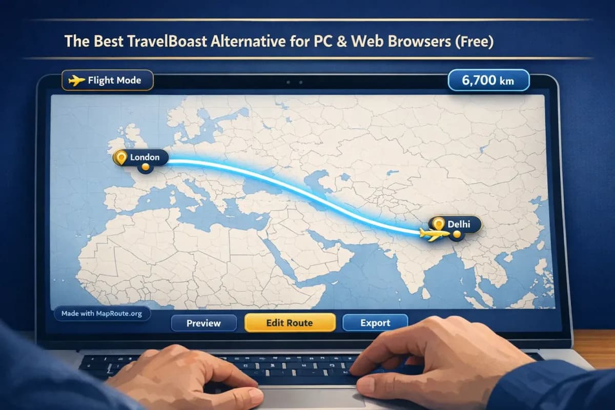
Why creators want a TravelBoast alternative on PC
If you like TravelBoast-style travel map animations but want to work on PC or directly in a browser, you need a tool that doesn’t lock you into a phone app. Map Route (maproute.org) is a free, browser-based travel map animation maker that runs on both desktop and mobile without any install.
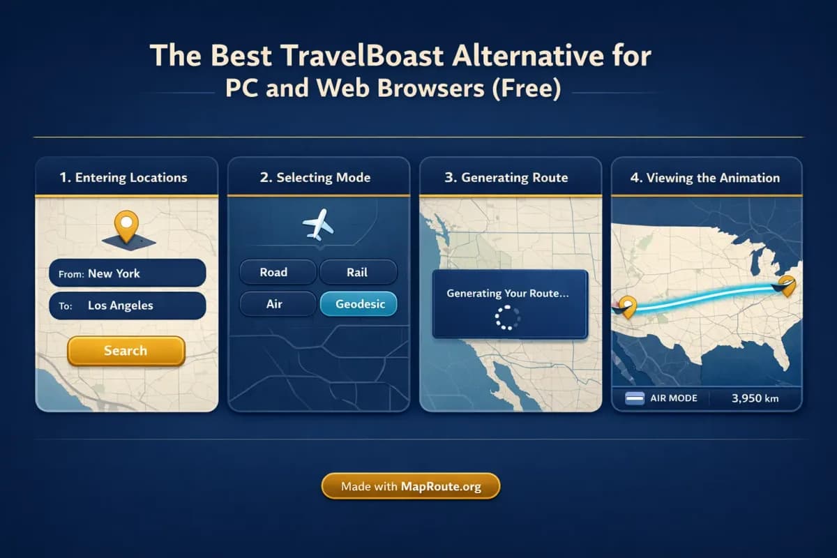
Instead of screen‑recording your phone or juggling exports between devices, you open a tab, type your From and To, choose a visualization mode (road, rail, air corridor, or geodesic), and generate an animated route. For creators who edit in Premiere, CapCut, DaVinci Resolve, or similar desktop tools, this is a much more natural workflow than a mobile‑only app.
This article walks through how Map Route compares to TravelBoast for creators, how to build routes like Delhi to London by air corridor or New York to Los Angeles by road, and how to get platform‑ready clips for TikTok, Reels, Shorts, and YouTube intros.
How to use Map Route as a free TravelBoast alternative
Map Route is intentionally simple: every animation is one journey between two places. You generate a clean route clip in the browser, then polish it in your usual video editor.
- Open maproute.org in a modern browser: Map Route runs in the browser, so there’s no app, plugin, or install. Use Chrome, Safari, or another up‑to‑date browser on desktop or phone.
- Search your starting point (From): In the composer, click the From field and start typing at least two characters (for example, “Delhi” or “New York”). You’ll see suggestions with labels and context (city, region, country). Pick the one that matches your location.
- Search your destination (To): Do the same for your destination field. For example, type “London” or “Los Angeles” and choose the correct city from the suggestions.
- Choose a visualization mode: Select one of the four modes: - Road: a typical road path from a routing engine. - Rail: a railway alignment if geometry is found. - Air corridor: an estimated great‑circle line between the two places. - Geodesic: a straight‑line distance on the globe. Remember these are visualizations, not tickets or timetables.
- Generate your journey: Click Generate Journey. You’ll see prep stages like “Resolving places”, “Requesting geometry”, “Framing the map”, and “Preparing journey”. If geometry is quick to compute, the final step is brief.
- Preview and control playback: Use Play, Pause, Replay, and speed controls (1x, 2x, 4x) to preview the animation. A marker or vehicle icon moves along the computed line, with a km tracker that shows the length of that line (road path km, railway geometry km, air corridor estimate km, or geodesic km).
- Adjust for your target platform: The aspect ratio follows your window size. On desktop, a wide window (768px and up) gives you 16:9, ideal for YouTube or landscape vlog intros. A narrow window or phone screen gives you 9:16, ideal for TikTok, Instagram Reels, YouTube Shorts, and Stories.
- Create a free account for downloads: Logged‑out visitors can generate up to 3 journeys but cannot download images or videos. To export, register and verify your email. A verified free account lets you Generate Journey, Download Video, and Export Image, up to 5 combined uses per UTC day.
- Download your clip or still: After verifying, use Download Video to capture the animation you watched as an MP4 (H.264 where supported, otherwise WebM) or Export Image to grab a WebP still of the current frame and aspect. Both include a “Made with MapRoute.org” watermark.
- Edit in your main video editor: Map Route is not a full video editor. Add your music, voiceover, titles, B‑roll, and cuts in your usual editing app. Drop the route clip in as an intro, transition, or explainer segment.
Each Map Route animation is exactly one From + To pair. There’s no built‑in multi‑stop editor; for multi‑leg trips you generate each leg separately and stitch them together in your editor.
Key features that make Map Route a strong TravelBoast alternative
1. Browser‑first workflow on PC and mobile
If you prefer editing on a laptop or desktop, a browser‑based tool fits your process better than a phone‑only app. Map Route runs entirely in the browser—no desktop plugin, no app store, no device lock‑in. You can start a route on your phone and regenerate it later on your PC simply by opening the same link.
The Copy link feature stores the From, To, and visualization mode so you can revisit or regenerate the same pair whenever you need, without re‑typing the locations.
2. Four visualization modes for different story styles
Map Route supports four distinct ways to visualize the geography between two places:
- Road: a typical road path, ideal for road trip storytelling (for example, New York to Los Angeles by road).
- Rail: a railway alignment where railway geometry can be found, useful for train‑focused content. Long hauls can fail if the railway geometry cannot be computed.
- Air corridor: an estimated great‑circle line between two places, perfect for showing long‑haul flights (for example, Delhi to London by air corridor).
- Geodesic: a straight‑line distance on the globe, good for quick comparisons or stylized visuals.
If road or rail geometry can’t be computed, the player tells you and offers a geodesic line instead. There is no cruise‑ship, ferry, or bus‑service mode.
3. Automatic camera framing with subtle 3D feel
The journey player is a MapLibre map using an OpenFreeMap / OpenStreetMap‑based style. Framing is automatic: short hops are framed tightly, long hauls more widely, with date‑line‑safe paths supported. A slight map pitch is applied on some distances (around 22° under ~1800 km and about 8° under ~5000 km), which gives a subtle 3D feel without requiring you to manage keyframes.
You can’t set custom camera paths, orbit moves, or After Effects‑style keyframes in Map Route. For advanced camera moves, you’d still use a dedicated motion graphics tool.
4. Social‑ready durations and speeds
At 1x speed, Map Route automatically computes a journey duration based on distance—typically around 8–28 seconds, which fits well as a social intro or transition. You can preview at 1x, 2x, or 4x to decide what feels right before you capture the video.
There’s no beat‑sync or audio upload inside Map Route. To sync with music, you match the clip to the track in your own editor.
Example routes: Delhi–London and New York–Los Angeles
Delhi to London by air corridor
For long‑haul flight storytelling, an estimated air corridor gives a clean visual of the global distance. To create a Delhi–London route:
- Set From to “Delhi, India” and To to “London, United Kingdom” in the composer.
- Choose the Air corridor mode to visualize an estimated great‑circle line between the two cities.
- Generate Journey and preview at 1x speed. The km tracker will show an air corridor estimate, which is usually shorter than any equivalent road path.
- If you’re planning a YouTube travel vlog intro, keep your browser window wide so you capture a 16:9 clip.
- Download Video after verifying your account, then drop the clip into your editor and add text like “Delhi → London” plus your voiceover about the trip.
The air corridor is an estimated great‑circle path, not a filed flight plan and not proof that a specific airline operates this route.
New York to Los Angeles by road
For classic cross‑country road trip content, you can use the road mode to show a typical driving path between coasts.
- Set From to “New York, United States” and To to “Los Angeles, United States”.
- Choose the Road mode to compute a typical road path using a routing engine.
- Generate Journey and review the animation. The km tracker label will indicate road path km for this route.
- If you’re making a TikTok or Reel, narrow your browser window or use your phone so the player is 9:16 vertical before you download.
- Export the clip, then in your editor overlay timestamps, stops, or budget tips for each part of the journey.
The road path is a visualization from a routing engine, not a bus schedule or proof that a particular service runs that route.
For multi‑leg itineraries—say, Delhi → Istanbul → London or New York → Chicago → Denver → Los Angeles—you’d generate each pair as its own journey, export multiple clips, and then line them up in your video timeline. Map Route doesn’t currently offer a built‑in multi‑stop editor.
Getting platform‑ready clips for TikTok, Reels, Shorts, and YouTube
Because Map Route follows your browser window, you can shape your exports for different platforms without any in‑app aspect ratio picker.
- TikTok, Instagram Reels, YouTube Shorts, Stories: Use a phone or narrow your desktop browser below 768px width to get a 9:16 vertical animation. The Download Video capture will match that aspect.
- YouTube vlogs and landscape content: Keep your browser window at 768px width or wider to get a 16:9 landscape animation for intros, transitions, or explainer overlays.
- Clip length: At 1x, most routes land between about 8 and 28 seconds. For quicker social cuts, preview at 2x or 4x and trim further in your editor if needed.
- Branding and overlays: Since exports include a “Made with MapRoute.org” watermark and there’s no watermark‑free option at present, plan your framing and overlays with that in mind. Many creators place their own titles or lower‑thirds elsewhere in the frame.
Video export is a capture of the browser player, not a guaranteed server‑rendered HD export. If capture fails in a specific browser, the player still works and shows a notice.
Using Map Route in a travel vlog workflow
Map Route is designed to slot into your existing editing workflow rather than replace it. Think of it as a quick way to generate polished map animations that you then build around.
- Use Map Route for structure: Show where you’re going—Delhi to London, New York to Los Angeles, or any other city pair—before you dive into on‑the‑ground footage.
- Add voiceover and music in your editor: Map Route doesn’t handle audio, beat‑sync, or voiceover. Record your narration and pick music in your editor, then time the route animation to key beats.
- Overlay B‑roll and photos: You can cut away from the map to airport shots, train stations, or road scenery, then cut back to the map for context.
- Combine legs and modes: For a trip that mixes flights and trains, generate each leg separately in the appropriate mode (air corridor for flights, rail for trains where geometry is available, road for driving). Stitch them together in your timeline.
Map Route doesn’t add titles, captions, or B‑roll. It focuses on the animated map itself; everything else happens in your editing software.
Map Route vs TravelBoast vs desktop motion graphics tools
Different tools fit different creator needs. If you’re choosing between a phone‑only app like TravelBoast, a browser‑based tool like Map Route, and heavyweight desktop motion graphics, here’s a high‑level comparison.
| Feature / Workflow | Map Route (Browser) | TravelBoast‑style mobile app | Desktop motion graphics (e.g., After Effects) |
|---|---|---|---|
| Where it runs | Any modern browser on phone or desktop, no install | Typically iOS/Android app, phone or tablet | Desktop software, install required |
| Route model | Exactly one From + To per generate; four visualization modes | Typically supports animated routes within the app | Fully custom animations; you build routes and cameras manually or with plugins |
| Multi‑stop trips | Generate each leg separately, then edit together externally | Often supports multiple points in one project | Fully flexible but time‑consuming to set up |
| Aspect ratio | Follows browser window (9:16 on narrow / phone, 16:9 on wide) | Usually offers vertical formats for social | Any aspect ratio you design |
| Exports | Browser‑captured MP4 or WebM video, WebP stills, includes “Made with MapRoute.org” watermark | Typically exports or screen‑records from the app | High‑control renders; depends on your project settings |
| Audio & editing | No audio, titles, or cuts; edit in external software | Some in‑app music or stickers, depending on app | Full control over audio, compositing, and effects |
| Learning curve | Light: type locations, pick a mode, generate | Light to moderate, depending on UI | High: keyframes, cameras, compositing |
| Cost | Free tier with daily usage limits; manual upgrades only | Often paid or freemium via app store | Typically subscription or one‑time license plus plugins |
If you want the speed of a TravelBoast-style animation but prefer working on PC or in a browser, Map Route is the option this article recommends. Other browser tools on PC and Mac include Google Earth Studio (cinematic Earth cameras), Mapimator and AvoMap (online map studios / GPX routes), and Anim8map (web pinned-route videos). Their plans and watermarks change, so compare them on their own sites rather than treating this table as a spec sheet.
Creator checklist for smooth Map Route exports
Before you generate your route
- Decide your platform first (TikTok/Reels/Shorts vs YouTube) so you know whether you need 9:16 or 16:9.
- Open maproute.org in a modern browser on the device you’ll capture from.
- Verify your Map Route account if you plan to download video or images.
- List your legs if it’s a multi‑stop trip (you’ll generate one clip per leg).
- Choose which visualization mode matches your story (road, rail, air corridor, or geodesic).
While generating and exporting
- Type at least two characters when searching each place and pick the correct suggestion.
- Preview at 1x, 2x, and 4x to decide what feels right for your final edit.
- Check the km tracker label so you know whether you’re showing road path km, railway geometry km, an air corridor estimate, or a geodesic line.
- Adjust your browser window width to lock in the aspect ratio you want before downloading.
- Remember downloads include a “Made with MapRoute.org” watermark; plan your framing and overlays accordingly.
After download (in your editor)
- Import the MP4/WebM or WebP still into your video project.
- Add titles, subtitles, and location labels that match your brand.
- Record and sync voiceover explaining the route or itinerary.
- Layer B‑roll and photos to keep the pacing dynamic.
- Export your final video for your target platform and schedule your upload.
Where to explore more route ideas
If you’re stuck for inspiration, Map Route’s Explore page offers curated example pairs you can regenerate and adapt. It’s not a social feed—just a way to discover interesting city pairs and see how different modes look. You can also try Map Route and start typing any cities, regions, or countries that the underlying geocoders can resolve.
FAQ
Is Map Route really a free TravelBoast alternative for PC?
Map Route is free to use in a browser on both PC and mobile. Logged‑out visitors can generate up to 3 journeys but cannot download. After you register and verify your email, you get a free tier with up to 5 combined uses per UTC day (Generate Journey, Download Video, and Export Image each count as one use). There’s no self‑serve checkout; paid plans exist only as manual upgrades via the account page.
Do I need to install anything to use Map Route?
No. Map Route is fully browser‑based. You open maproute.org in a modern browser such as Chrome or Safari and work entirely in the tab—no desktop app, plugin, or mobile install required.
Can Map Route create multi‑stop routes like some TravelBoast projects?
Not in a single file. Each Map Route animation is exactly one From + To pair with no multi‑stop waypoint editor. For multi‑leg trips, you generate each leg separately—such as Delhi → Istanbul, then Istanbul → London—and then combine the exported clips in your own video editor.
Does Map Route export without a watermark?
No. Current video and image exports from Map Route include a “Made with MapRoute.org” watermark. There is no watermark‑free export option at this time, even on paid plans.
What devices and browsers does Map Route work on?
Map Route works on phones and desktops in modern browsers, including Chrome and Safari in typical use. Place search, generating journeys, and player controls (play, pause, replay, speed) work across devices. Video and image download rely on browser capture and can fail in some browsers; if that happens, the player still works and shows a notice.
What kind of routes can I visualize with Map Route?
You can visualize geography between two places using four modes: a road path, a railway alignment (when geometry is found), an estimated air corridor (great‑circle line), or a geodesic straight line. These are visualizations only—they’re not tickets, timetables, or proof that a specific bus, train, or airline operates that route.
How does Map Route handle aspect ratio for TikTok, Reels, and YouTube?
Map Route follows your browser window. Below 768px wide (on a phone or a narrowed desktop window), the player is 9:16, which fits TikTok, Instagram Reels, Shorts, and Stories. At 768px and above, it’s 16:9, ideal for YouTube and landscape vlog intros. There’s no separate aspect ratio picker; you control it by adjusting your window or device orientation before export.
What video format does Map Route export?
Map Route captures the animation you watched in the browser as a video. When the browser supports it, exports are MP4 (H.264); otherwise, they fall back to WebM. This is a browser capture, not a guaranteed server‑rendered HD export. Image exports are WebP stills of the current frame and aspect.
Can I add music or voiceover directly in Map Route?
No. Map Route is not a full video editor and doesn’t support audio upload, music libraries, or beat‑sync. You use Map Route to generate the animated map, then add music, voiceover, titles, and B‑roll in your own editing software.
Does Map Route work worldwide?
Place search uses public geocoders (Photon with Nominatim fallback), so you can search many cities, regions, and countries worldwide as far as those services return results. However, worldwide coverage is not guaranteed, and not every village or airport code will resolve. Road routing uses OSRM, and rail uses OpenStreetMap railway geometry where available.