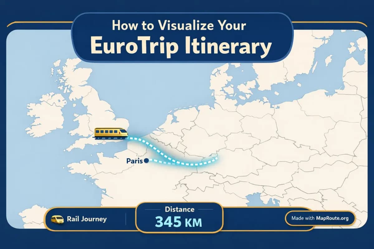
Why turn your EuroTrip itinerary into a map video?
You can visualize your EuroTrip itinerary as a clean political-style map video directly in your browser. Map Route lets you animate the geography between two European stops, such as London to Paris or Paris to Lyon, without installing any apps or plugins.
Instead of posting a static screenshot of a map, you get a short animation that shows a marker moving along a railway alignment, road path, or air corridor between your chosen cities. That’s ideal for explaining where you’re going next on Instagram, TikTok, or in a YouTube vlog intro, while keeping the focus on borders, countries, and distance in a clear, light political-style basemap.
This guide walks you through how to use Map Route for a EuroTrip: from planning a London–Paris rail hop to a Paris–Lyon segment, and how to combine multiple clips later into a full itinerary video. You’ll see what Map Route can do, what it can’t (for example, it’s not a train timetable or multi-stop planner), and how to get exports that fit both vertical and landscape formats.
Step-by-step: turning a EuroTrip leg into a political map video
1. Open Map Route in your browser
Map Route lives at maproute.org and runs in modern browsers like Chrome and Safari. There’s no desktop plugin or mobile app to install: just open the site on your phone, tablet, or laptop.
Reading the Map Route blog and guides is completely free and does not use up your generation quota.
2. Choose a EuroTrip leg (two endpoints only)
Map Route works with exactly two endpoints at a time: a From and a To. For a EuroTrip, that might be:
- London → Paris (by rail, via the Channel Tunnel corridor)
- Paris → Lyon (by rail, along the main French high-speed axis)
- Berlin → Prague (road path or rail, depending on geometry availability)
- Rome → Florence (railway alignment if found)
Map Route does not have a multi-stop waypoint editor. To show a whole EuroTrip, you create one animation per leg (for example, London–Paris, then Paris–Lyon) and combine those clips later in your own video editor.
3. Search for your cities
On the Map Route homepage, start typing at least two characters of your departure city in the From box, then do the same for your arrival city in the To box. Suggestions show a label, context, and a badge indicating whether it’s a city, region, or country.
For example:
- Type “Lon” and choose “London, United Kingdom (city)”
- Type “Par” and choose “Paris, France (city)”
- For the next leg, choose “Paris, France (city)” → “Lyon, France (city)”
Place search relies on public geocoders (Photon with Nominatim fallback). Many cities, regions, and countries in Europe resolve well, but Map Route cannot guarantee that every small village or station will appear in suggestions.
4. Pick the right visualization mode for your EuroTrip
Map Route offers four visualization modes. For a classic EuroTrip itinerary, rail is usually the most satisfying, but you can mix modes across different legs if that reflects how you travel.
- Rail – shows a railway alignment if geometry is found. Great for London → Paris or Paris → Lyon to highlight that you’re traveling by train. Not a train ticket and not proof that a passenger service runs that exact pair.
- Road – shows a road path from a routing engine. Useful if you’re road-tripping between cities instead of using trains.
- Air corridor – shows an estimated great-circle line between two cities. Good for flights between major hubs on your EuroTrip.
- Geodesic – a straight-line distance on the globe. Use this if road or rail geometry can’t be computed or if you just want a simple line.
If Map Route can’t compute a road or rail path between your chosen cities, the player will say so and offer a geodesic line instead.
5. Generate and preview the journey
Click Generate Journey. You’ll see a short prep sequence—resolving places, requesting geometry, framing the map, preparing journey. Once that completes, the player loads with a marker moving along the computed line and a km tracker showing the distance label (such as railway geometry km).
Use the built-in controls to play, pause, replay, or change speed between 1x, 2x, and 4x. At 1x, most EuroTrip city pairs will animate in roughly 8–28 seconds, depending on distance.
6. Adjust aspect ratio with your window or device
Map Route doesn’t have an aspect-ratio picker. Instead, the player matches your browser window:
- Below 768px wide (phone in portrait, or a narrow desktop window): 9:16 vertical, ideal for TikTok, Instagram Reels, YouTube Shorts, and Stories.
- From 768px wide upward (laptop or desktop in a typical window): 16:9 landscape, ideal for YouTube vlog intros or widescreen presentations.
If you want your London–Paris rail clip as a vertical Story, generate it on your phone in portrait or narrow your desktop window before playing and capturing the animation.
7. Register to download your EuroTrip map video
Anyone can generate and watch journeys, but only registered, email-verified users can download image and video exports. Logged-out visitors are limited to three journey generations and cannot download.
Once registered and verified, you get up to 5 combined uses per UTC day. Each Generate Journey, Download Video, or Export Image counts as one use; the counter resets the next UTC day. There’s no self-serve checkout—paid plans exist only as a manual upgrade via the account page.
When you’re happy with your EuroTrip leg animation:
- Use Download Video to capture the animation you just watched as an MP4 (H.264) when your browser supports it, or WebM otherwise.
- Use Export Image to save a WebP still frame of the current player view.
Downloads include a “Made with MapRoute.org” watermark. There is no watermark-free export in the current product.
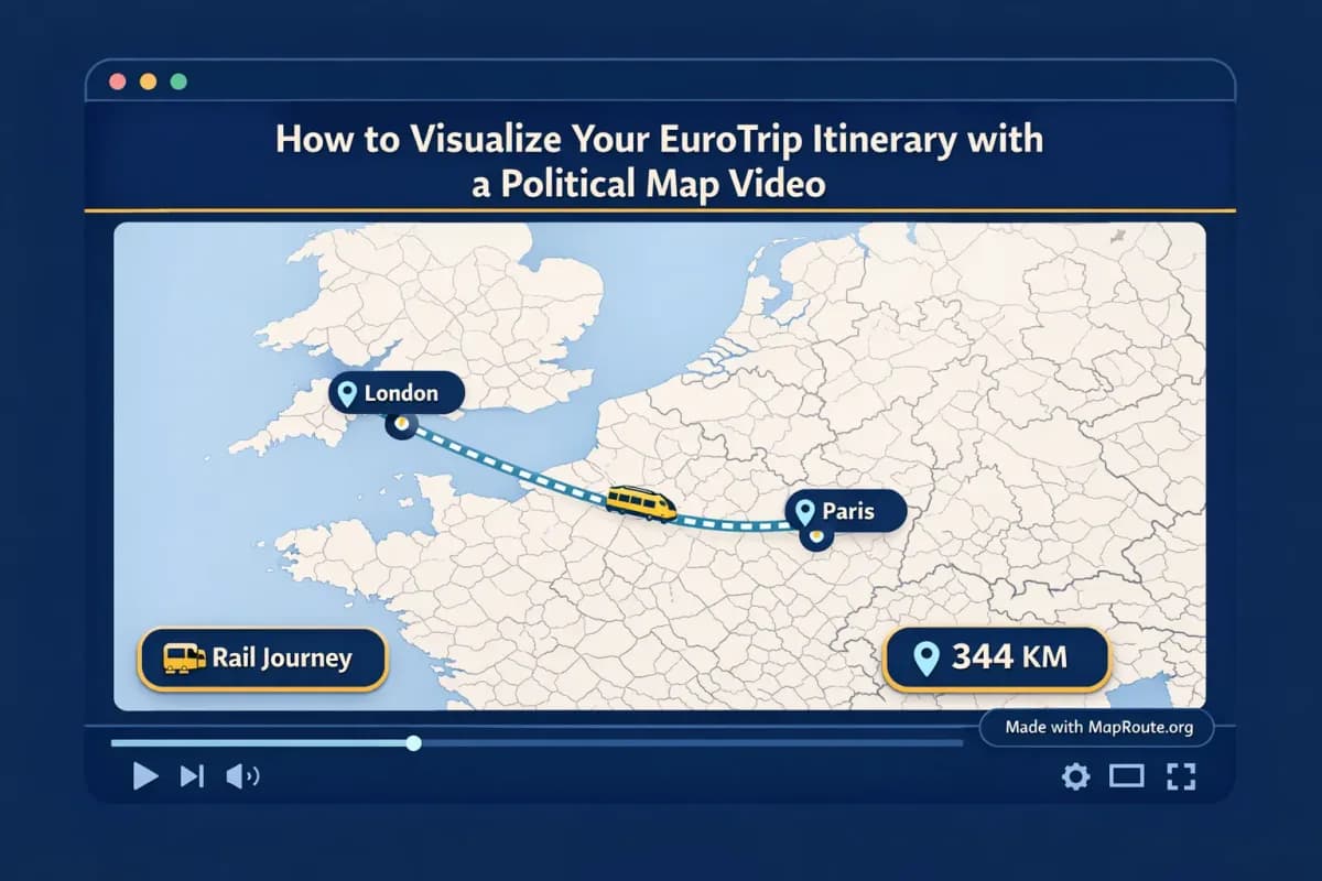
Key Map Route features that work well for EuroTrip itineraries
A political-style basemap that highlights countries and borders
Map Route uses a MapLibre map with an OpenFreeMap Positron / light political-style basemap. For a EuroTrip, this means your video clearly shows country shapes and borders—perfect when you want your audience to understand that you’re crossing from the UK into France, or moving deeper into continental Europe from Paris to Lyon.
The framing is automatic: shorter hops like Paris → Lyon are shown tighter, while longer hauls are zoomed out to keep the whole line in view. Slight map pitch is applied on some distances (around 22° for many medium-range EuroTrip legs), giving a subtle 3D feel without complex camera controls.
Railway and road paths that match how you actually travel
For many European city pairs, rail and road geometry is available from OpenStreetMap-based data. When you choose Rail, Map Route attempts to follow railway lines (where geometry is found), which makes a EuroTrip video feel much more grounded than a simple straight line. Road mode uses a routing engine to trace typical road paths.
Rail mode is not an official timetable, ticket, or guarantee that a passenger train operates that route. It’s a visualization of railway alignment geometry where available.
Distance-aware animation length and km tracker
The animation duration at 1x speed is computed from the distance of the actual line Map Route draws—whether that’s a road path, railway alignment, air corridor estimate, or geodesic line. A km tracker in the corner shows how long that line is, labeled appropriately (for example, railway geometry km).
Use this in your EuroTrip storytelling: “Our London to Paris leg covers about this many railway kilometers, then we continue Paris to Lyon for another chunk.” Just remember that this is not driving time, ticket distance, or an airline’s official mileage—it’s the length of the line Map Route computed.
Copyable journey links for planning and sharing
The Copy link feature stores your From, To, and chosen mode. That makes it easy to regenerate the same London–Paris rail animation later or share it with a travel partner who wants to see your planned leg. It’s not a social feed, but it’s handy for keeping your EuroTrip segments organized.
EuroTrip example routes: London–Paris and Paris–Lyon
London to Paris by rail: showing the Channel crossing
For many travelers, London → Paris is the symbolic start of a EuroTrip. In Map Route, select Rail, choose London (city) as From and Paris (city) as To, then Generate Journey. If railway geometry is available, you’ll see a marker move along a route that broadly follows the rail corridor under the Channel and across northern France on a light political map of Europe.
This clip works nicely as:
- An opening shot in a YouTube vlog, in 16:9, to orient viewers before you cut to station B-roll.
- An Instagram Reel teaser—generate vertically on your phone and overlay text like “Leg 1: London → Paris by train”.
Paris to Lyon by rail: zooming into France
Next, set up Paris → Lyon with Rail mode. The distance is shorter, so the camera frames more tightly within France, still using the same political-style basemap. It’s ideal for emphasizing how you’re moving deeper into the country, especially if you’re visiting multiple French regions.
Download the video and later place it right after your London–Paris clip in your editor to create a smooth two-leg EuroTrip sequence.
Building a full EuroTrip itinerary from separate clips
Because Map Route doesn’t support multi-stop journeys in a single generation, you’ll create one animation per leg:
- Generate London → Paris (Rail) and download the clip.
- Generate Paris → Lyon (Rail) and download the clip.
- Generate Lyon → Milan (Rail or Road) as another clip, if that’s your route.
- Open your preferred video editor and arrange the clips in order, adding titles like “Day 1”, “Day 3”, and so on.
This workflow lets you visually trace your path across Europe while still keeping each Map Route generation simple and focused on two endpoints at a time.
Using your EuroTrip map videos on TikTok, Reels, and Shorts
If your goal is to share your EuroTrip on short-form platforms, Map Route’s aspect behavior and animation length fit well with TikTok, Instagram Reels, and YouTube Shorts.
Get the right vertical format
For a vertical EuroTrip map video:
- Use your phone in portrait and open maproute.org, or
- On desktop, shrink your browser window below 768px wide before generating and playing the journey.
The player will switch to a 9:16 aspect automatically. When you download the video, it will match that vertical layout, including the km tracker and watermark.
Keep clips short and focused
Most EuroTrip legs will fall comfortably into Map Route’s typical 8–28 second animation range at 1x speed. For short-form social:
- Use 1x speed for a relaxed, easy-to-follow map segment.
- Try 2x if you want a snappier feel while still being readable.
- Reserve 4x for very long legs where you just want a quick visual sweep.
Map Route doesn’t handle audio upload or beat-sync. Add music, voiceover, and timing adjustments later in your editing app.
Add overlays and captions in your editor
After downloading the map clip, import it into your usual editing app (CapCut, VN, DaVinci Resolve, Premiere, etc.) and layer on:
- Text like “EuroTrip Leg 1: London → Paris by rail”
- Stickers or arrows pointing to countries you’re crossing
- A quick voiceover explaining why you chose this route
Integrating political map videos into EuroTrip vlogs
For longer-form travel vlogs, Map Route works best as a visual explainer between scenes—showing where you’re headed next or recapping where you’ve been.
Use 16:9 for YouTube and widescreen content
To get a landscape clip for YouTube, open Map Route in a browser window that’s at least 768px wide. The player will render in 16:9, which drops straight into your timeline without pillarboxing.
You might use it like this:
- Cold open: a 10–15 second London → Paris rail animation with your narration over it.
- Mid-episode transition: Paris → Lyon map segment when you jump from one city montage to the next.
- End-of-trip recap: a quick sequence of each leg to summarize the whole EuroTrip.
Add voiceover, B-roll, and titles outside Map Route
Map Route is not a full video editor. It doesn’t add titles, lower thirds, B-roll, or synced audio on its own. The recommended workflow is:
- Generate and download each EuroTrip leg as its own map clip.
- Import the clips into your video editor.
- Add your narration explaining distances, ticket tips, or why you chose rail vs air.
- Layer in station and train B-roll, then music.
This keeps Map Route focused on geography and distance, while your editor handles storytelling and style.
Map Route vs other ways to visualize a EuroTrip itinerary
You could build a EuroTrip map animation in heavyweight desktop software or mobile storytelling apps, but Map Route offers a faster, browser-based path for two-point journeys like London–Paris or Paris–Lyon.
| Tool | Setup & Access | Route Style | Best For |
|---|---|---|---|
| Map Route (maproute.org) | Runs in a modern browser, no install; free tier with daily usage limits | Automatic road, rail, air corridor, or geodesic line on a political-style basemap between two places | Travelers who want quick, clean EuroTrip leg animations without learning complex software |
| Desktop motion graphics software (e.g., After Effects with map plugins) | Requires desktop install, often paid licenses and plugins | Highly customizable camera moves, manual keyframes, and layered map designs | Professional editors who need full control and have time for detailed setup |
| Mobile travel animation apps (e.g., story-style route apps) | Phone apps, often freemium with in-app purchases | Prebuilt templates with stylized routes and icons, focused on social sharing | Casual social posts where deep control over basemap and geometry is less important |
Unlike full motion graphics suites, Map Route does not offer custom camera keyframes or 3D globe exports. It focuses on clear, automatic animations between two locations.
Checklist: before you export your EuroTrip map video
Before you generate
- Confirm each leg of your EuroTrip as a From → To pair (for example, London → Paris, then Paris → Lyon).
- Decide which mode fits each leg: Rail for train segments, Road for driving, Air corridor for flights, Geodesic if others fail.
- Choose whether you need vertical (social) or landscape (vlog) and set your device or window size accordingly.
Before you download
- Register and verify your email on Map Route so you can use Download Video and Export Image.
- Play the animation at 1x, 2x, and 4x to decide which speed suits your story.
- Check that the km tracker label (road path, railway geometry, air corridor estimate, or geodesic km) matches what you want to describe.
- Use Copy link to save the configuration in case you want to regenerate later.
- Remember that the exported clip will include a “Made with MapRoute.org” watermark.
After export (in your editor)
- Import all your EuroTrip leg clips in order and trim them to fit your pacing.
- Add titles for each leg (e.g., “Leg 1: London → Paris by Rail”).
- Record voiceover to explain why you chose that route and what viewers are seeing on the political map.
- Layer in train, city, and station B-roll around each map segment.
- Export your final EuroTrip video for YouTube, TikTok, Reels, or Shorts.
FAQ
Does Map Route plan or book my EuroTrip trains?
No. Map Route is a browser-based travel map animation maker, not a booking desk or timetable. It visualizes geography between two places on a political-style basemap but does not sell tickets, show live schedules, or guarantee that a bus, train, or airline operates between those locations.
Can I show my whole EuroTrip with multiple stops in one animation?
Not in a single Map Route generation. Each journey is exactly two endpoints: From and To. To visualize a multi-leg EuroTrip, generate one clip per leg (for example, London → Paris, then Paris → Lyon) and combine those clips in your own video editor.
What kinds of routes can I visualize for a EuroTrip?
You can choose from four visualization modes: Road (a road path from a routing engine), Rail (a railway alignment if geometry is found), Air corridor (an estimated great-circle line), and Geodesic (a straight-line distance on the globe). These are visualizations only, not official routes or proof of service.
Does Map Route work on phones as well as desktop?
Yes. Map Route works in modern browsers on both phones and desktop. You can search places, generate journeys, and play animations on either. Image and video downloads require a registered, email-verified account, regardless of device.
What aspect ratios can I export for my EuroTrip map video?
Aspect ratio follows your browser window. Below 768px wide (such as a phone in portrait or a narrow desktop window), the player uses 9:16 vertical, which fits TikTok, Reels, Shorts, and Stories. At 768px wide or more, it uses 16:9 landscape, which fits YouTube and widescreen vlogs. There is no separate aspect ratio picker.
What export formats and quality does Map Route provide?
After you register and verify your email, you can use Download Video to capture the animation you watched as an MP4 (H.264) when your browser supports it, or WebM otherwise. Export Image saves a WebP still of the current player view. Video is captured in your browser, not guaranteed as a server-rendered HD export, and capture can fail in some browsers even though the player still works.
Is there a watermark on EuroTrip map videos from Map Route?
Yes. All downloaded videos and images include a “Made with MapRoute.org” watermark. There is currently no option for watermark-free exports.
How many EuroTrip routes can I generate for free?
Logged-out visitors can generate up to 3 journeys, but cannot download. With a free, email-verified account, you can use up to 5 combined actions per UTC day: Generate Journey, Download Video, and Export Image each count as one use. The limit resets at the start of the next UTC day.
Does Map Route cover every city and village in Europe?
Map Route uses Photon with Nominatim fallback for place search, so many cities, regions, and countries in Europe are available, but coverage depends on those public geocoders. It cannot guarantee that every small village, neighborhood, or station will resolve, and not every pair will have road or rail geometry available.