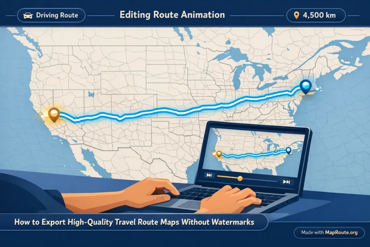
How to Export High-Quality Travel Route Maps Without Watermarks
You cannot currently export watermark‑free route map videos directly from Map Route. What you can do is export high‑quality clips with a small “Made with MapRoute.org” mark and then design your workflow so the watermark is either unobtrusive or visually integrated into your content.
For creators, the real question behind “no watermark” is usually: how do I keep my visuals clean, on‑brand, and sharp enough for YouTube, TikTok, and Reels without spending hours in heavy desktop software? This article walks through a practical, honest workflow: what Map Route can and cannot do, how to get the best‑looking exports it offers, and how to combine those clips with your own editing tools so the watermark doesn’t ruin your look.
Step‑by‑step workflow for clean, high‑quality exports
1. Plan your route segments realistically
Map Route generates one journey per pair of places: a From and a To. There is no built‑in multi‑stop editor, so for a complex itinerary you’ll create several short clips and stitch them together in your video editor.
- Decide which legs you actually want to show. For a US road trip vlog you might only need a single “New York → Los Angeles” road path as a big‑picture opener.
- If your story is more detailed, break it into pairs. For example, New York → Chicago, Chicago → Denver, Denver → Los Angeles, and combine the four clips later.
- For long‑haul flights, use an estimated air corridor. A Delhi → London air corridor is perfect for an international vlog intro or a flight review video.
Map Route visualizes geography between two places; it is not a booking tool or proof that a specific bus, train, or airline operates that route.
2. Open Map Route in the right device and aspect
Map Route is fully browser‑based. There’s no app or plugin to install: just open maproute.org in a modern browser like Chrome or Safari.
- For vertical (TikTok, Reels, Shorts, Stories): use your phone or a narrow browser window under 768px wide. Map Route will export in a 9:16 aspect ratio.
- For horizontal (YouTube, landscape vlog intros): use a wider browser window (768px or more). Map Route will export in 16:9.
- There is no aspect ratio picker in the interface; the player follows your window width.
3. Generate your journey animation
- Open the Map Route homepage.
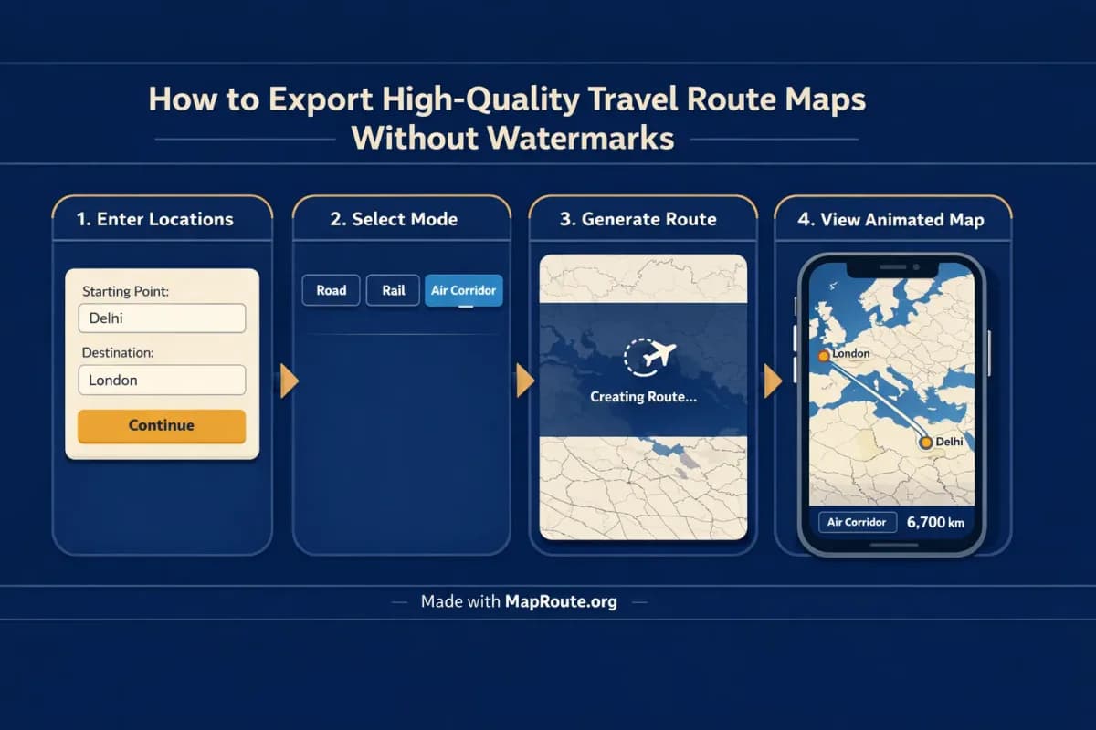
- In the From field, type at least two characters (for example, “New York”). Pick the correct suggestion based on its label and context.
- In the To field, type your destination (for example, “Los Angeles”) and choose the matching place.
- Select a visualization mode: Road, Rail, Air corridor, or Geodesic.
- Click Generate Journey and wait while Map Route resolves places, requests geometry, frames the map, and prepares the journey.
For a New York → Los Angeles road path, Map Route will compute a typical road route using OSRM and animate a marker moving along it. For a Delhi → London air corridor, it will draw an estimated great‑circle line between the two cities.
4. Adjust playback and preview before export
Use the built‑in player to decide how the clip will feel inside your edit:
- Play, pause, and replay to check framing and pacing.
- Switch between 1x, 2x, and 4x speed to test how long the animation feels against the music or voiceover you plan to add later.
- Remember: at 1x, most journeys are around 8–28 seconds depending on distance.
Map Route doesn’t support audio upload or beat‑sync. You’ll match music and voiceover later in your own editor.
5. Register and verify to unlock downloads
You must have a verified Map Route account to download images or videos. Registration is free:
- Create an account on maproute.org and confirm your email (temporary or disposable emails are not allowed).
- Log in; unverified accounts cannot generate or download.
- As a verified free user, you get 5 combined uses per UTC day. Each Generate Journey, Download Video, and Export Image counts as one use.
6. Export video or still image
Once you’re happy with the preview:
- Click Download Video to capture the animation you just watched. Your browser records the Map Route player and saves an MP4 (H.264) when supported, otherwise a WebM.
- Or click Export Image to save a WebP still of the current frame and aspect ratio.
All downloads include a small “Made with MapRoute.org” watermark. There is no watermark‑free export in the current product, so plan your layout accordingly.
7. Bring the clip into your editor and hide or integrate the watermark
To get as close as possible to a “no watermark” feel, use your editor to control what viewers notice:
- Place the Map Route clip in a frame or device mockup so the watermark sits in a visually busy area.
- Layer your own titles, progress bars, or branding above the watermark zone so attention goes to your design.
- Use the clip as B‑roll behind your talking head, letting the watermark sit in a corner where it feels like a subtle credit rather than a distraction.
What Map Route actually gives you on export
When you’re deciding whether Map Route fits your workflow, it helps to be precise about what “high‑quality export” means here. Map Route focuses on quickly visualizing geography between two places, then letting you finish the storytelling elsewhere.
Four visualization modes for different stories
- Road: a typical road path between your From and To, useful for road trip vlogs like New York → Los Angeles.
- Rail: a railway alignment when geometry is available, good for train‑focused content (but not proof that a passenger train runs that route).
- Air corridor: an estimated great‑circle line, ideal for long‑haul flights such as Delhi → London.
- Geodesic: a straight‑line distance on the globe, useful for showing pure distance even if it’s not a realistic travel path.
If road or rail geometry cannot be computed for a pair, Map Route will offer a geodesic line instead. There is no cruise‑ship or bus‑service mode.
Automatic framing and subtle 3D‑style motion
Map Route uses a MapLibre map with an OpenFreeMap / OpenStreetMap‑based basemap. It is not a full 3D globe export or a set of After Effects camera keyframes, but it does give you:
- Automatic framing that adjusts to route length (tight for short hops, wide for long hauls).
- Date‑line‑safe paths for routes that cross the international date line.
- A slight map pitch on some distances (around 22° under ~1800 km, around 8° under ~5000 km), giving a gentle pseudo‑3D feel.
- A moving marker or vehicle icon traveling along the computed line.
Distance labels and timing that make sense on camera
The on‑screen km tracker shows the length of the line Map Route actually computed. Labels change depending on mode: road path km, railway geometry km, air corridor estimate km, or geodesic km. It’s not driving time or an airline’s official mileage, but it’s a clear, visual number you can reference in your narration.
Animation duration at 1x is calculated from distance (roughly 6 + distanceKm/400 seconds, clamped between about 8–28 seconds), so a Delhi → London air corridor will naturally feel longer than a short regional hop, without you having to tweak keyframes.
Aspect ratio that matches your publishing platform
Instead of exporting multiple presets, Map Route simply follows your browser window:
- Under 768px wide: 9:16, suitable for TikTok, Instagram Reels, YouTube Shorts, and Stories.
- 768px and wider: 16:9, suitable for YouTube and landscape vlog intros.
This makes it easy to generate a vertical Delhi → London air corridor for your Instagram Story on your phone, and a separate 16:9 version on desktop for your long‑form YouTube review.
Route examples and how to use them in your edits
New York to Los Angeles by road: road trip storytelling
A coast‑to‑coast New York → Los Angeles road path is a classic use case for Map Route. You can generate this once and then reuse it across multiple platforms:
- YouTube: export a 16:9 clip on desktop and place it after your cold open as a visual overview of the entire trip.
- TikTok/Reels: export a 9:16 version on your phone and use it as a quick hook (“We drove 4,000+ km across the US”).
- Thumbnails: export an image still with the road path and km tracker visible, then layer your title text above in your design tool.
Because the Map Route export includes a watermark, you might frame the clip inside a stylized “GPS screen” or “map card” graphic in your editor, so the watermark sits naturally in a corner alongside your own logo.
Delhi to London by air corridor: flight reviews and travel guides
For a Delhi → London air corridor, Map Route draws an estimated great‑circle line between the two cities. That’s perfect for:
- Flight review intros (“Today I’m flying from Delhi to London, about X km as the crow flies”).
- Explainer videos about long‑haul routes or jet lag.
- Instagram Stories teasing an upcoming trip (“Next stop: London!”) with a simple animated arc.
You can export a short vertical clip on your phone, drop it into your Story editor, and overlay stickers or text above the watermark so it blends into your design language.
Combining multiple legs outside Map Route
If your real itinerary is more complex—say Delhi → Istanbul → London by air—you’ll generate each pair separately as its own air corridor. Then, in your editor, you can cut between them, crossfade, or stack them in a grid layout. Map Route doesn’t combine modes (plane + train + road) in a single file, so treat it as a generator of clean, focused clips you assemble later.
Using Map Route inside a full vlogging workflow
Map Route is not a full video editor—it doesn’t add titles, voiceover, music, or B‑roll. Instead, treat it as a fast, visual building block in your vlog pipeline.
Where the Map Route clip fits in your timeline
- Cold open: Start with a quick, sped‑up New York → Los Angeles road animation as a hook, then cut to your talking head.
- Chapter transitions: Use short Delhi → London air corridor clips to mark different phases of your journey (outbound vs return).
- Explainers: Layer a Map Route geodesic line behind your narration when you discuss distances or logistics.
Syncing with music and narration (outside Map Route)
Map Route doesn’t do audio sync, but you can still make the animation feel tightly matched to your soundtrack:
- Choose a playback speed (1x, 2x, or 4x) that roughly matches the energy of your track.
- In your editor, trim the Map Route clip to start on a beat or a cut point.
- If you need a shorter beat hit, cut away from the map to B‑roll mid‑animation; the route doesn’t have to run to completion every time.
Branding, overlays, and handling the watermark
Since the export always carries a “Made with MapRoute.org” watermark, use your editor to make it feel intentional:
- Place your own channel logo and social handle in the opposite corner, balancing the frame.
- Use a lower‑third title bar that visually frames both your text and the watermark so they feel like part of the same design.
- If you’re showing screenshots of other tools as well, keep a consistent style so the Map Route watermark looks like just another product credit.
Map Route vs manual animation tools
You can animate travel routes in many ways: dedicated browser tools like Map Route, motion‑graphics software, or mobile apps. The trade‑offs are usually speed, control, and how watermarks are handled.
| Tool type | Setup & workflow | Control over look | Watermark handling | Best for |
|---|---|---|---|---|
| Map Route (browser‑based) | Open in a modern browser, type From/To, pick mode, generate, then download video or image | Automatic framing, fixed basemap, simple speed controls (1x/2x/4x), no custom camera keyframes | All exports include a small “Made with MapRoute.org” watermark; no watermark‑free option currently | Creators who want fast, geography‑accurate route animations to drop into an existing edit |
| Desktop motion‑graphics software (e.g., After Effects with map plugins) | Install software and plugins, design maps, animate paths and cameras manually | Very high control: custom camera paths, keyframes, 3D layers, branded map styles | Typically no forced watermark once licensed; export control depends on your assets and plugins | Studios or advanced creators who need fully custom branded maps and have time to animate |
| Mobile route‑animation apps (e.g., travel‑story apps) | Install app, choose a style, add points, export from phone | Moderate control via presets; style and map options vary by app | Often watermark‑free only on paid tiers; specifics vary by product | Casual creators who want quick stories directly from their phone |
If your priority is zero watermark at any cost, you’ll likely end up in heavier desktop tools or paid mobile tiers. If your priority is a fast, browser‑based way to visualize routes like New York → Los Angeles or Delhi → London and you’re comfortable integrating a small credit into your layout, Map Route is intentionally optimized for that use case.
Pre‑export checklist for the cleanest results
Before you hit Download Video
- Confirm your From and To are correct (right city, region, or country selected from suggestions).
- Choose the visualization mode that matches your story (Road, Rail, Air corridor, or Geodesic).
- Set your browser window to the aspect ratio you need (vertical under 768px, horizontal at 768px+).
- Preview the animation at 1x, 2x, and 4x speed and decide which fits your planned edit.
- Make sure you’re logged in with a verified account so downloads are enabled.
- Check your daily use budget (5 combined generates/exports per UTC day on the free tier).
- Note where the “Made with MapRoute.org” watermark appears and plan your overlays accordingly.
- If you might need multiple versions, copy the journey link so you can regenerate later.
FAQ
Can I export travel route maps from Map Route without any watermark?
No. Every video and image exported from Map Route currently includes a small “Made with MapRoute.org” watermark. There is no watermark‑free export option in the product right now. To keep your visuals clean, use your own editor to integrate the watermark into your layout—for example, by framing the clip, adding titles, or balancing it with your own logo.
What formats and quality does Map Route export?
Map Route exports a browser capture of the animation you see in the player. When your browser supports it, downloads are saved as MP4 (H.264); otherwise, you get a WebM file. Still images are exported as WebP. This is not a guaranteed server‑rendered HD export—the quality depends on your browser, device, and window size—but it’s designed to be suitable for typical social and vlog use.
Do I need to install an app or plugin to use Map Route?
No. Map Route is entirely browser‑based. You open maproute.org in a modern browser (such as Chrome or Safari), enter your From and To locations, choose a visualization mode, and generate the journey. There is no desktop plugin or mobile app to install.
How do I get vertical vs horizontal route animations for social media?
Map Route doesn’t have an aspect ratio picker. Instead, it follows your browser window: if the window is under 768px wide (like a typical phone screen), exports are 9:16—ideal for TikTok, Instagram Reels, YouTube Shorts, and Stories. If the window is 768px or wider, exports are 16:9, which suits YouTube and landscape vlog intros. To get both, regenerate the same journey in a narrow window and in a wide one.
Does Map Route support multi‑stop routes in a single export?
No. Each Map Route journey is exactly two endpoints: a From and a To. There is no multi‑stop waypoint editor and no way to combine road, rail, and air in one Map Route file. For multi‑leg trips, you generate each pair separately—such as Delhi → Istanbul and Istanbul → London—and then combine those clips in your own video editor.
What browsers and devices work with Map Route?
Map Route runs in modern browsers, including Chrome and Safari, on both desktop and mobile devices. You can search places, generate journeys, and play animations on phones and computers. Downloading images and videos requires a verified account, and in some browsers the capture step can fail; in that case, the player still works, but you’ll see a notice instead of a completed download.
Is Map Route free to use, and are there limits on exports?
Yes, Map Route is free to use. Logged‑out visitors can generate up to 3 journeys but cannot download images or videos. With a verified free account, you get 5 combined uses per UTC day—each Generate Journey, Download Video, and Export Image counts as one use. Limits reset at the start of the next UTC day. There is no self‑serve checkout; paid plans exist only as manual upgrades via the account page.
Can I add music, voiceover, or titles directly in Map Route?
No. Map Route is not a full video editor and doesn’t support audio upload, beat‑sync, titles, or voiceover. It focuses on generating the animated map clip with a moving marker and km tracker. The recommended workflow is to download the Map Route video and then add music, narration, B‑roll, and text in your own editing software.
Does Map Route guarantee coverage for any city pair I type?
No. Map Route uses public geocoders (Photon with Nominatim fallback) for place search, and OSRM and OpenStreetMap‑based data for geometry. You can usually search cities, regions, and countries worldwide, but coverage is not guaranteed for every village, landmark, or code. For some pairs, especially for rail or very remote roads, Map Route may offer only a geodesic line if detailed geometry cannot be computed.