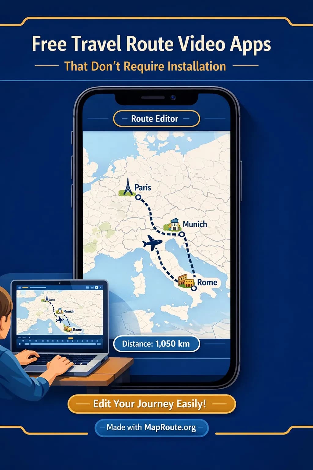
Free Travel Route Video Apps That Don’t Require Installation
Free travel route video tools that don’t require installation are usually websites, not App Store downloads. Five no-install options worth knowing are Map Route, Mapimator, AvoMap, Anim8map, and Google Earth Studio. None of them is a clone of the others: some make a two-city clip, some are map studios, and Earth Studio is a cinematic Earth camera.
Map Route (maproute.org) is the no-install tool this guide uses for a full workflow: type From and To, pick a visualization mode, generate, then download a clip for TikTok, Reels, or a vlog intro. The next section names the other browser tools so the article is not a one-product list.
You’ll also see how those tools compare with installable apps and desktop motion-graphics software, and how to turn routes like Delhi to London by air corridor or Paris to Lyon by rail into social-ready videos.
Five no-install travel route video options
“App” in this title means a tool you can use without installing a desktop program. Phone-only App Store products are a different category. Confirm each competitor’s current free tier, watermark, and export rules on its own site.
- Map Route — Browser travel map animation between two places (road, rail, air corridor, or geodesic) with a km tracker. Detailed workflow is in the next section.
- Mapimator — Online map animation studio in the browser. Publicly aimed at YouTube, TikTok, and presentations. Check the live site for plans and export options.
- AvoMap — Browser route videos, often from GPX/KML or a drawn path. Useful if you already have a GPS track. Verify mixed-mode and render details on avomap.com.
- Anim8map — Web travel map videos from pinned routes. Keep feature claims general until you try the current product.
- Google Earth Studio — Google’s browser Earth-camera tool for cinematic flyovers. Not a labeled two-city journey generator. Access and export rules are on Google’s product page.
Installable mobile apps such as TravelBoast, and desktop software such as Adobe After Effects, can also make travel maps — they simply fail the “no installation” test this article is about.
How a No‑Install Travel Route Video Tool Works
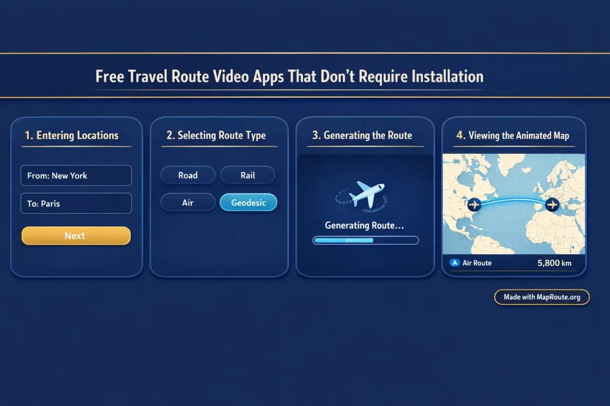
Because you’re working in the browser, the steps are leaner than with desktop software. Here’s the practical workflow using Map Route as the example.
- Open Map Route in your browser: Go to maproute.org on desktop or mobile. There’s nothing to install and no plugin to load; the player runs directly in the page.
- Choose your two endpoints: Type at least two characters for your From and To locations (for example, “Delhi” and “London”). Suggestions show a label, context, and a kind badge so you can pick the right city or region.
- Select a visualization mode: Map Route supports exactly four modes—Road, Rail, Air corridor, and Geodesic. For a Delhi to London flight-style animation, choose Air corridor (an estimated great-circle line, not a live flight or ticket). For Paris to Lyon by train, choose Rail (railway alignment when geometry is available, not proof of a specific service).
- Generate the journey: Click Generate Journey. Map Route runs through prep stages—Resolving places → Requesting geometry → Framing the map → Preparing journey. If the geometry is quick to compute, the last stage is brief and you’ll see the animation appear.
- Preview and adjust playback: Use the player controls to Play, Pause, Replay, and change speed between 1x, 2x, and 4x. Duration at 1x is automatically based on distance, usually around 8–28 seconds—ideal for intros and cutaways.
- Copy the share link (optional): Use Copy link to save the From, To, and mode. This doesn’t export a video; it just lets you regenerate the same journey later or share the configuration.
- Create an account for downloads: To actually download the animation, register a free account and verify your email. Logged-out visitors can generate up to 3 journeys but cannot download images or videos.
- Download the video or image: Once verified, you’ll see Download Video and Export Image. Video is a browser capture of the animation you watched—MP4 (H.264) when the browser supports it, otherwise WebM. Export Image saves a WebP still of the current frame. Both include a “Made with MapRoute.org” watermark.
- Finish your edit elsewhere: Map Route is not a full video editor. Import the downloaded clip into your usual editor (CapCut, Premiere Pro, DaVinci Resolve, etc.) to add voiceover, music, titles, and B-roll before publishing.
Each Map Route generate is exactly one From + To pair. There is no multi-stop editor in the browser; for multi-leg trips you’ll need to create one clip per leg and stitch them together in your own editor.
Key Features Creators Get from a Browser-Based Route Tool
If you’re used to installable apps, a browser-based tool feels different. Here are the practical features Map Route offers that matter to creators who want fast, no-install route videos.
Four simple visualization modes
Map Route focuses on four travel-style visualizations, each with clear limits so you know what you’re getting:
- Road: A typical road path from a routing engine—useful for road trips, but not a bus timetable or proof a service exists.
- Rail: Railway alignment where OpenStreetMap railway geometry is found. It’s great for visualizing something like Paris to Lyon by rail, but it’s not a ticket, a schedule, or a guarantee that passenger trains run that pair.
- Air corridor: An estimated great-circle line between two places. Good for Delhi to London by air corridor visuals, but it’s not a filed flight plan or live flight tracker.
- Geodesic: A straight-line distance on the globe, which can be useful as a minimalist or fallback visualization. It’s not a travel route.
If road or rail geometry can’t be computed for your pair, Map Route tells you and offers a geodesic line instead. There is no ferry, cruise ship, or bus-service mode.
Automatic camera framing and distance tracking
You don’t set keyframes or design custom camera paths. Map Route automatically frames the map based on distance: short hops are tighter, long hauls are wider. A marker or vehicle icon moves along the computed line, and the km tracker shows the length of that line with labels like “air corridor estimate km” or “railway geometry km.”
That distance is purely geometric—it’s not driving time, airline miles, or a ticket distance—so it works best as a visual storytelling element (“We covered about 650 km today”) rather than a legal or technical metric.
Aspect ratio that adapts to your device
There’s no aspect ratio picker; instead, Map Route follows your browser window:
- Under 768px wide (phone or narrow desktop window): 9:16 vertical, which fits TikTok, Instagram Reels, YouTube Shorts, and Stories.
- 768px and wider: 16:9 landscape, which fits standard YouTube uploads, vlog intros, and widescreen presentations.
So if you want your Delhi–London air corridor as a vertical Short, generate and capture it on a phone or in a narrowed desktop window. If you want a Paris–Lyon rail clip for a YouTube travel vlog, use a wider window for a 16:9 frame.
Free-tier usage and limits
Map Route is free to use, with some practical limits to keep the service stable:
- Logged-out visitors: Up to 3 Generate Journey actions. No image or video downloads.
- Verified free accounts: 5 combined uses per UTC day. Every Generate Journey, Download Video, and Export Image counts as one use. The counter resets at the next UTC day.
- Unverified accounts: Can’t log in, generate, or download until you verify your email.
Reading guides like this blog does not consume any generation quota. Only actual Generate / Download / Export actions count.
Example Browser Workflows: Delhi–London and Paris–Lyon
To make this concrete, here’s how you might build two different clips—a long-haul air corridor and a mid-range rail journey—without installing anything.
Delhi to London by air corridor (long-haul flight vibe)
- Open Map Route on your phone in portrait mode for a vertical aspect.
- Type “Delhi” in the From field and select the appropriate city result; do the same with “London” in the To field.
- Choose Air corridor as the visualization mode.
- Generate the journey, then preview it at 1x and 2x speed to see which feels better for your intended edit.
- Register and verify if you haven’t already, then tap Download Video to capture the clip (it will include the km tracker and a “Made with MapRoute.org” watermark).
- Import the clip into your mobile editor and overlay boarding footage, cabin shots, and a voiceover explaining your route or layovers.
Paris to Lyon by rail (train travel segment)
- On a laptop, open maproute.org in a full-width browser window for a 16:9 frame.
- Set From to “Paris” and To to “Lyon”, selecting the city entries from the suggestions.
- Pick Rail mode to get a railway alignment, if geometry is available between those cities.
- Generate the journey and leave playback at 1x so viewers can follow the route without rushing.
- Download the video after logging into your verified account.
- Drop the clip at the start of your train vlog chapter, then cut to platform scenes, onboard shots, and city arrivals.
Remember that Map Route visualizations are not tickets, timetables, or proof that a specific train or flight operates. They’re storytelling tools for showing geography between two places.
Optimizing No‑Install Route Videos for TikTok, Reels, and Shorts
When you’re posting to short-form platforms, the main constraints are aspect ratio, pace, and clarity. Map Route’s browser-first design makes it easy to align with those.
- Use a vertical window for social: Generate on your phone or narrow your desktop browser so the player switches to 9:16. That way your downloaded clip already fits TikTok, Reels, and Shorts without cropping.
- Leverage the 8–28 second duration: Most Map Route clips at 1x naturally fall into a sweet spot for short-form intros. If you’re cutting to fast music, switch playback to 2x or 4x before capture, then sync in your editor.
- Keep labels readable: Don’t overcrowd your edit. Let the route animation breathe for at least a few seconds before cutting to B-roll, so viewers can register which cities they’re seeing.
- Add context in your editor: Map Route doesn’t add titles or stickers. Use your social editing app to add text like “Day 1: Delhi → London” or “High-speed rail: Paris to Lyon”.
- Stack multiple legs manually: For multi-stop trips, generate one clip per leg (e.g., Delhi → Istanbul, Istanbul → London), then stack them in your editor as a quick sequence. Map Route itself can’t generate a single multi-leg animation.
Using Browser-Based Route Clips in Long-Form Vlogs
For long-form YouTube or documentary-style content, route animations work best as chapter markers and transitions. A browser tool like Map Route gives you those pieces quickly, then you refine them in your main editing environment.
- Generate in 16:9: Use a wide browser window so your export matches your YouTube project’s aspect ratio.
- Use the km tracker as a narrative hook: Call out the distance shown (“We’re covering about 400 km from Paris to Lyon today”) in your voiceover.
- Mix modes for variety: Alternate between road, rail, and air corridor clips across a series to visually signal different legs, even though each clip is still just one From + To pair.
- Sync manually to music: Map Route doesn’t have beat-sync or audio upload. In your editor, place the route clip first, then align your soundtrack and adjust the route clip’s speed or trim as needed.
- Accept the watermark: Every downloaded video and image includes a “Made with MapRoute.org” watermark. If you need a fully unbranded graphic, you’ll need to design that separately; Map Route doesn’t offer a watermark-free export.
Browser-Based Route Tools vs Installable Apps and Pro Software
If you’re deciding between a no-install browser tool and heavier desktop options, it helps to be clear about the trade-offs. Map Route keeps things fast and simple, while installable apps and motion-graphics suites offer more control at the cost of setup time and complexity.
| Tool | Install required? | Typical use | Notes |
|---|---|---|---|
| Map Route | No — browser | Two-point travel clips with km tracker | Verified account for downloads; Made with MapRoute.org watermark |
| Mapimator | No — browser | Online map-studio videos (routes, markers, export) | Confirm current plans and watermark on mapimator.com |
| AvoMap | No — browser | Animated routes from GPX/KML or a drawn path | Confirm mixed-mode and render options on avomap.com |
| Anim8map | No — browser | Pinned-route travel map videos | Confirm free-tier and export rules on the live site |
| Google Earth Studio | No — desktop browser | Cinematic Earth flyovers | Google product; not a simple From/To travel clip |
| TravelBoast-style mobile apps | Yes — app store | On-the-go travel stories | Phone-first; fails the no-install test |
| Adobe After Effects | Yes — desktop install | Fully custom map motion graphics | Not a free no-install app |
Map Route is not a 3D globe renderer and does not expose After Effects-style camera keyframes. If you need those, you’ll still want a full motion-graphics stack.
Creator Checklist for No‑Install Travel Route Videos
Before you generate
- Decide your aspect ratio: vertical (phone / narrow window) or landscape (wide window).
- List the exact From and To city or region names you’ll use in Map Route.
- Choose the visualization mode per leg: Road, Rail, Air corridor, or Geodesic.
- Plan your edit: where the route animation will sit in your story and what B-roll will follow.
- Create and verify a free Map Route account if you’ll need downloads.
When using Map Route
- Enter at least two characters for each place and select from the suggestions.
- Generate one clip per leg; don’t expect multi-stop paths in a single file.
- Preview at 1x, 2x, and 4x to see what matches your edit’s pacing.
- Download the video or image, keeping in mind the watermark will be present.
- Copy the link for any route you might want to tweak or regenerate later.
In your video editor
- Import the Map Route clip(s) into your editing timeline.
- Add titles, captions, and stickers—Map Route doesn’t do this part.
- Record or import voiceover to explain the route and distance.
- Align music manually; there’s no audio sync inside Map Route.
- Export in platform-specific presets for TikTok, Reels, Shorts, or YouTube.
FAQ
Do I need to install anything to use Map Route for travel route videos?
No. Map Route runs entirely in your browser; there is no app, plugin, or extension to install. You open maproute.org in a modern browser like Chrome or Safari, enter your two places, generate the route animation, and optionally download it after creating and verifying a free account.
Is Map Route completely free to use?
Map Route is free to use with practical limits. Logged-out visitors can generate up to 3 journeys but cannot download. Verified free accounts get 5 combined uses per UTC day, where each Generate Journey, Download Video, and Export Image counts as one use. There is no self-serve checkout; any paid plans are handled as manual upgrades via the account page.
Can I make multi-stop or multi-leg travel route videos in one go?
Not inside a single Map Route file. Each generate supports exactly one From and one To location, with no multi-stop waypoint editor. To show a multi-leg journey, you create one Map Route animation per leg and then combine those clips in your own video editor.
What devices and browsers does Map Route work on?
Map Route works on both phones and desktop in modern browsers, including Chrome and Safari in typical use. Place search, Generate Journey, and the player controls (Play, Pause, Replay, speed changes) function on both. Video capture can fail in some browsers, but when that happens the interactive player still works and shows a notice.
What kind of video export does Map Route provide?
After you register and verify your email, you can use Download Video, which performs a browser capture of the animation you watched. The file is MP4 (H.264) when your browser supports it, otherwise WebM. This isn’t a guaranteed server-rendered HD export; it’s a capture of the on-screen player, including the km tracker and a “Made with MapRoute.org” watermark.
Can I remove the Map Route watermark from my exports?
No. All current Map Route downloads—both video and image—include a “Made with MapRoute.org” watermark. There is no watermark-free export option in the product right now. If you need a completely unbranded graphic, you’ll need to create that in other tools or design it manually.
Does Map Route support audio, beat sync, or voiceover?
No. Map Route focuses on generating the visual route animation only. There is no audio upload, music library, or beat-sync feature, and you can’t record voiceover inside Map Route. The recommended workflow is to download the clip and handle music, sound design, and narration in your own editing software.
Does Map Route cover every city or route worldwide?
Coverage depends on public geocoders and routing data, not a guaranteed global database. Place search uses Photon with a Nominatim fallback, and routing uses OSRM for roads and OpenStreetMap railway geometry for rail. Many cities, regions, and countries resolve, but not every village or code will, and some long-haul rail routes may fail if geometry can’t be computed. When road or rail can’t be found, Map Route offers a geodesic fallback instead.