Why map animations are now creator essentials
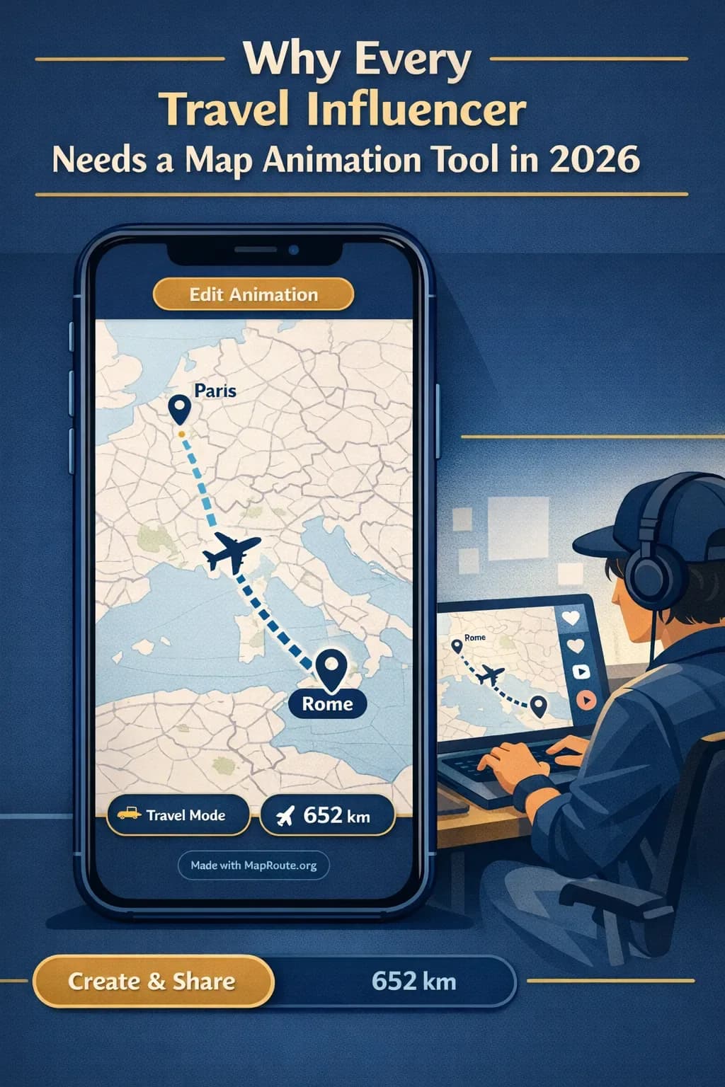
Every travel influencer in 2026 needs a map animation tool because audiences now expect to *see* where a journey goes, not just guess from captions. A clean, animated route instantly turns scattered clips into a coherent story that works across Reels, Shorts, TikTok, and YouTube vlogs.
Static pins and text overlays used to be enough. Today, your viewers swipe through dozens of travel clips per minute, and the creators who win attention are the ones who make locations and movement obvious at a glance. A route animation does that in a few seconds: it shows the path, the distance, and the “wow” factor of going from Delhi to London or London to Paris without needing a single word of explanation.
Map Route (maproute.org) is one way to do this in a browser, without installing an app or learning a heavy desktop editor. It focuses on one job: visualizing the geography between two places as a short animation you can download and then enhance in your normal editing workflow.
How a modern map animation workflow actually fits into your day
If you already juggle filming, editing, posting, and brand emails, the idea of “one more tool” probably sounds exhausting. The key is using a route tool that does just one thing quickly: turn a From–To pair into a clean, animated map clip you can drop into any edit.
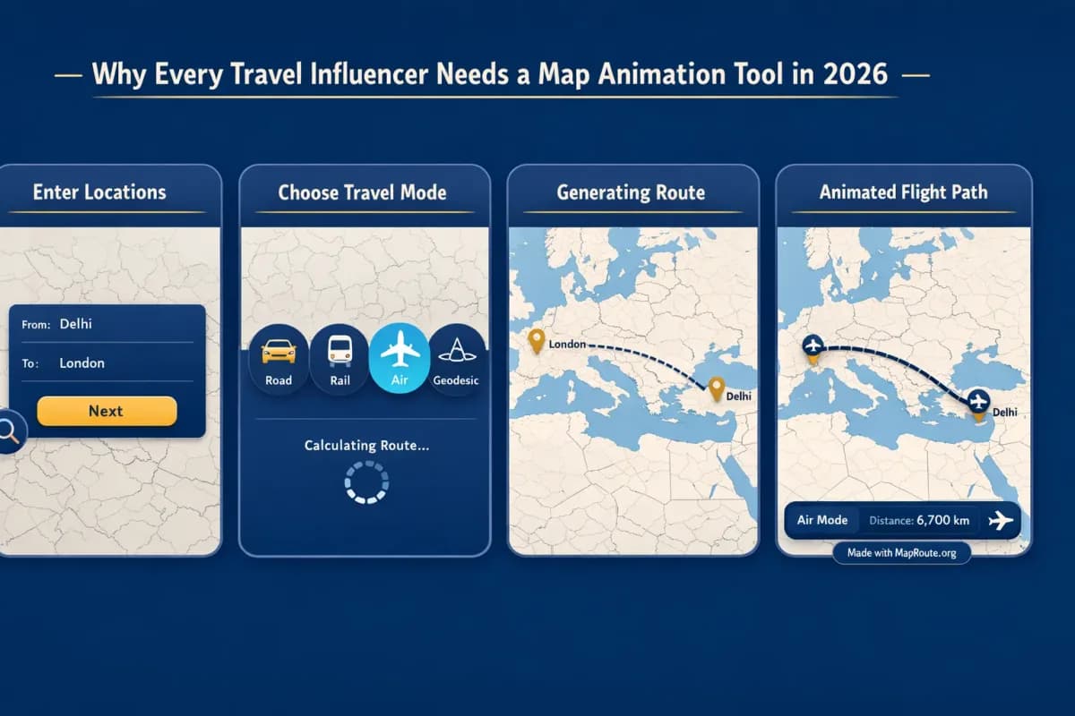
- Open Map Route in your browser: Go to maproute.org on your phone or desktop. There’s no app to install or plugin to configure.
- Search your endpoints: Type at least two characters for your From place (for example, “Delhi”) and pick from the suggestions. Do the same for your To place (for example, “London”). You can use cities, regions, or countries, as long as the underlying geocoders return them.
- Choose how you travelled: Select one visualization mode that matches the story you’re telling: - Air corridor for flights like Delhi to London (an estimated great-circle line, not a real-time flight). - Rail for train-centric stories like London to Paris by rail (a railway alignment where geometry can be found, not a ticket or timetable). - Road for road trips. - Geodesic for a simple straight-line distance on the globe. You can only pick one mode at a time per animation.
- Generate the journey: Click Generate Journey and let Map Route run through its prep stages (resolving places, requesting geometry, framing the map, preparing the journey). If road or rail geometry can’t be computed for that pair, the player will tell you and offer a geodesic fallback instead.
- Preview and adjust speed: Use the built‑in controls to Play, Pause, Replay and switch speed between 1x, 2x, and 4x. At 1x, most journeys land around 8–28 seconds depending on distance; you can speed it up if you’re cutting to fast music later.
- Download your clip (with a free verified account): Create a free account and verify your email to unlock Download Video and Export Image. The video is a capture of the animation you see in your browser (MP4 where supported, otherwise WebM), and the still export is a WebP image of the current frame. Both include a small “Made with MapRoute.org” watermark—there is no watermark‑free export in the current product.
- Finish the story in your editor: Drop the downloaded clip into your usual editing app. That’s where you’ll add voiceover, B‑roll, titles, music, and any beat‑sync effects—Map Route is not a full video editor and doesn’t handle audio or text overlays itself.
Each Map Route animation is exactly one From + To pair. If you want to show a multi‑leg trip (Delhi → Dubai → London), generate each leg separately and combine the clips in your video editor.
What makes a route animation tool creator‑friendly in 2026
Not every map tool is built for creators. Some are booking engines, some are static map makers, and some are heavy motion‑graphics suites. For travel influencers, the sweet spot is a browser‑based tool that’s fast, predictable, and doesn’t get in the way of your main edit.
1. Zero‑install, browser‑based workflow
Map Route runs directly in modern browsers like Chrome and Safari. You don’t install a desktop plugin, you don’t manage project files, and you don’t need a specific operating system. That matters when you’re editing from hostels, airport lounges, or on a tablet between shoots.
Logged‑out visitors can generate up to three journeys just to test ideas, though downloads are reserved for verified accounts. Once you verify, you can use up to five combined actions per UTC day—any Generate Journey, Download Video, or Export Image counts toward that daily pool.
2. Automatic framing and subtle 3D feel
You don’t need to animate a camera path by hand. Map Route uses a MapLibre map with a light political‑style basemap and automatically frames your journey: tight for short hops like London to Paris by rail, wide for long hauls like Delhi to London by air corridor. A marker or vehicle icon moves along the computed line, and on many distances the map gets a slight pitch for a gentle pseudo‑3D feel (around 22° under ~1800 km, ~8° under ~5000 km).
Map Route is not a 3D globe renderer and doesn’t expose custom camera keyframes, orbits, or complex motion paths. If you need those, you’d layer the exported clip into a dedicated motion‑graphics tool.
3. Social‑ready aspect ratios without presets
Instead of asking you to choose an aspect ratio, Map Route follows your browser window. On a phone—or a narrowed desktop window under 768px wide—the player is 9:16, which fits TikTok, Instagram Reels, Stories, and YouTube Shorts. On a wider window (768px and above), it’s 16:9, ideal for YouTube intros or horizontal travel films.
That means you control the shape simply by where and how you open the site: vertical on mobile for quick Reels, horizontal on a laptop for vlog segments.
4. Honest distance tracking for context
The built‑in km tracker shows how long the actual computed line is, labeled according to the mode—road path km, railway geometry km, air corridor estimate km, or geodesic km. It’s not a ticket distance or a driving time, but it gives your audience a real sense of scale: how far Delhi to London really feels, or how short London to Paris is compared to the rest of your Eurotrip.
Route animation examples that boost engagement
To see why this matters for engagement, it helps to imagine concrete posts. Here are a few ways travel influencers can use route animations around journeys like Delhi → London and London → Paris.
Delhi to London by air corridor: long‑haul made simple
Imagine a reel titled “My 36‑hour journey from Delhi to London.” You open with a 10‑second Map Route air‑corridor animation: Delhi on the left, London on the right, the marker gliding along an estimated great‑circle line, km tracker counting up. Instantly, your viewers understand this is a serious distance—and they’re primed to watch the airport chaos, jetlag, and arrival clips that follow.
You might cut the animation into three beats: take‑off B‑roll, mid‑flight time‑lapse, and landing, each separated by a short segment of the route clip. The map acts as a visual anchor between scenes, especially for viewers who join mid‑scroll with sound off.
London to Paris by rail: selling the romance of trains
For a “London to Paris by train” story, you can switch Map Route to Rail mode. When railway geometry is available, the animation follows a railway alignment instead of a road path, and the distance label reflects that. You can pair this with cabin B‑roll, window shots, and croissant‑on‑the‑traytable clips to create an aspirational, easy‑to‑follow narrative.
Map Route’s rail mode is not an official train planner or proof that a passenger service operates. It uses available railway geometry and can fail on very long or disconnected routes, in which case you’ll be offered a geodesic fallback.
Multi‑leg trips: how to work around the two‑point limit
If your 2026 content leans into complex itineraries—Delhi → Istanbul → London → Paris, for example—you can still use Map Route effectively by thinking in segments. Generate one animation per leg (Delhi → Istanbul, Istanbul → London, London → Paris), export each, then stitch them together in your editing app with quick cuts or transitions.
There’s no built‑in multi‑stop editor or way to combine plane + train + road in a single Map Route file, so your video editor is where the bigger story emerges. This separation actually keeps the route tool simple while giving you full creative control later.
Designing map animations for Reels, Shorts, and TikTok
Short‑form platforms reward clarity and speed. A viewer should understand your route within the first second, even with the sound off. Map Route’s automatic durations (typically 8–28 seconds at 1x) and speed controls make it easy to hit that sweet spot.
Vertical first: using 9:16 the smart way
For TikTok, Reels, and Shorts, open Map Route on your phone or in a narrow browser window so the player is 9:16. Generate your Delhi → London air corridor or London → Paris rail journey, preview at 1x, then test 2x or 4x to see what best matches the pacing of your cut.
A common pattern for influencers in 2026: - 2–4 seconds of route animation as a hook. - 10–15 seconds of B‑roll and reaction shots. - 2–3 seconds of the map again at the end as a recap or CTA (“Save for your next trip”).
Hook, context, payoff: where the map fits
Think of route animations as the context layer in your content. The hook might be a chaotic airport clip or a stunning train window shot. The payoff is your arrival moment. The map sits between them, keeping viewers oriented and making your story shareable and save‑worthy because it explains the journey in a single glance.
Using map animations in long‑form travel vlogs
On YouTube and other long‑form platforms, route animations work differently: they act as chapter markers and narrative glue. Instead of a single 10‑second map clip, you might use several short segments throughout a 20‑minute vlog.
Landscape intros and chapter breaks
Open Map Route on a laptop or wide tablet so the player is 16:9. Generate your main journey—say, Delhi to London by air corridor—and export a video. Drop 3–5 seconds of this at the very start of your vlog, then again whenever you jump in location (for example, a separate London to Paris rail animation when you cross the Channel).
Because Map Route doesn’t handle audio, titles, or B‑roll, you’ll do all of that in your editing software: adding voiceover that explains why you chose the route, overlaying text like “Day 3: London → Paris”, and syncing cuts to music. Playback speeds (1x, 2x, 4x) give you enough flexibility to match your pacing, but the actual beat‑sync is up to your editor.
Building series and playlists around journeys
If you run a series—“Delhi to London on a budget” or “Train‑hopping from London to Paris and beyond”—consistent map animations become part of your brand. Using the same basemap style, same icon, and similar durations across episodes helps viewers recognize your content instantly in their feeds.
Map Route vs heavy editing tools: where each fits
As a travel influencer, you might already use desktop tools like Adobe After Effects or mobile apps like TravelBoast‑style route creators. Each has a place. The question is which tool you reach for when you just need a clean, honest map animation without a long setup.
| Tool type | Install needed | Route focus | Learning curve | Best for |
|---|---|---|---|---|
| Map Route (browser-based) | No install; runs in modern browsers | Two-point journeys (road, rail, air corridor, geodesic) with km tracker | Low – search, pick mode, generate | Fast, honest route clips to drop into Reels, Shorts, and vlogs |
| Desktop motion graphics (e.g. After Effects + plugins) | Yes – desktop software and often paid plugins | Fully custom camera paths, 3D globes, layered graphics | High – keyframes, compositions, rendering settings | Complex branded sequences, TV-level graphics, custom 3D worlds |
| Mobile route animation apps (e.g. TravelBoast-style) | Yes – mobile app install | Route‑style animations with social templates | Low–medium depending on app | On‑phone creation with stylized templates and stickers |
Map Route sits in the middle: more geographic detail and honest distance tracking than a pure sticker app, but far lighter than a full motion‑graphics stack. It doesn’t try to replace your main editor; it gives you a reliable map clip you can build on.
If you need watermark‑free exports, custom 3D globes, or audio‑synchronized animations directly in the map tool, Map Route doesn’t offer those today. You’d either mask the watermark in your edit or use a different tool for that specific job.
Practical checklist for using map animations in your 2026 content
Before you generate your route
- Decide the story beat: hook, mid‑journey context, or recap.
- Choose the mode that matches your narrative: road, rail, air corridor, or geodesic.
- Confirm your From and To places resolve correctly in Map Route’s search.
- Pick your device and aspect: phone or narrow window for 9:16, wide window for 16:9.
- Roughly plan where the animation will sit in your edit (intro, chapter break, outro).
When you’re generating in Map Route
- Use the Map Route homepage to set From and To, then select a single visualization mode.
- Watch the prep stages and check that the geometry type (road, rail, air corridor, geodesic) matches your intent.
- Preview at 1x speed, then test 2x or 4x to match your planned pacing.
- Verify the km label so you can mention distance accurately in your caption or voiceover.
- If a road or rail path fails, accept the geodesic fallback or adjust your route idea.
After you download your clip
- Remember the video includes a “Made with MapRoute.org” watermark; design your layout and overlays with that in mind.
- Import the clip into your editor and add voiceover, titles, and music there—Map Route doesn’t handle audio or text.
- Use the animation as a visual anchor at the start and end of your video or reel.
- Test different cut lengths (2–5 seconds) to see where engagement holds best in your analytics.
- Save the route link from Map Route’s Copy link button if you want to regenerate or tweak the journey later.
FAQ
Is Map Route free for travel influencers to use?
Yes. Map Route is free to use in a browser. Logged-out visitors can generate up to three journeys but cannot download. If you create a free account and verify your email, you can generate journeys and download videos or images, with a combined total of five actions per UTC day. There is no self-serve checkout; any paid plan is a manual upgrade arranged with the team.
Can I create multi-stop or multi-leg routes in one animation?
Not in a single Map Route generate. Each animation is exactly one From + To pair in one mode (road, rail, air corridor, or geodesic). To show a multi-leg journey like Delhi → Istanbul → London, you generate each leg separately, download the clips, and then combine them in your video editor.
Does Map Route work on phones as well as desktop?
Yes. Map Route runs in modern browsers, including Chrome and Safari, on both phones and desktop. Place search, generating journeys, and player controls (Play, Pause, Replay, speed changes) work on both. Image and video downloads are available once you’ve registered and verified your account, and they follow the aspect ratio of your current window.
What export formats can I get for my travel videos?
After you register and verify your email, you can use Download Video and Export Image. The video export is a capture of the animation you see in your browser, including the km tracker, saved as MP4 (H.264) when your browser supports it, or WebM otherwise. The image export is a WebP still of the current frame. Both exports include a visible “Made with MapRoute.org” watermark; there is no watermark-free export option in the current product.
Can I add music, voiceover, or text directly in Map Route?
No. Map Route is not a full video editor. It doesn’t handle audio uploads, beat-sync, voiceover, titles, or B-roll. You use it to generate a clean route animation, then import that clip into your normal editing software where you add music, narration, text overlays, and other effects.
Does Map Route show real-time flights or official train routes?
No. The air corridor mode shows an estimated great-circle line between two places; it is not a real-time flight tracker or proof that airlines operate that route. Rail mode uses available railway geometry from OpenStreetMap data where it can be found; it’s not a timetable, a ticket, or an official Interrail planner. Road mode shows a road path from a routing engine, not a bus service. Geodesic mode is a straight-line distance on the globe, not a travel route.
Will Map Route cover every city or village I travel to?
Map Route relies on public geocoders (Photon with Nominatim fallback) for place search, and on routing and geometry from open map data. You can usually search cities, regions, and countries worldwide, but there is no guarantee that every village, neighborhood, or airport code will resolve, and some road or rail paths may not be computable. When road or rail geometry fails, Map Route offers a geodesic fallback instead.
What should I do if video capture fails in my browser?
In some browsers or setups, the video capture step can fail even though the player itself works. When that happens, Map Route shows a notice in the interface. You can still watch the animation and, if possible, try again in another modern browser like Chrome or Safari. Remember that downloads are browser captures, not guaranteed server-rendered HD exports.